This 1850 map is a recreation of an original 1850 Somerset County map. The area hasn't changed, but towns have forged their own mark on history.
As a historian, I believe maps are one of the greatest sources of information, capturing a time and place. We use these maps to research history and find buildings, families, farms, or streets. We often compare those historic maps to current maps. Then, we go on a journey to find that actual location today. Once in a while, we take our research and create maps to give perspective. #readytoremember.
We love studying the history of New Jersey food – diners, sandwiches, bars, and more.
| Mapping New Jersey’s Most Iconic Diners | |
| Jersey Comfort Food – Mapping The Best of the Best! | |
| Finding New Jersey’s Giant Pizzas | |
| Distillers in New Jersey Map – Tell us when a new distillery fires up. | |
| The Only Map of New Jersey Dive Bars | |
| Jersey’s History with Bar Room Shuffleboard |
| Princeton University New Jersey Map Collection 1666-1888 | |
| NEW JERSEY 1873 Color | |
| New Jersey 1814 Color Map | |
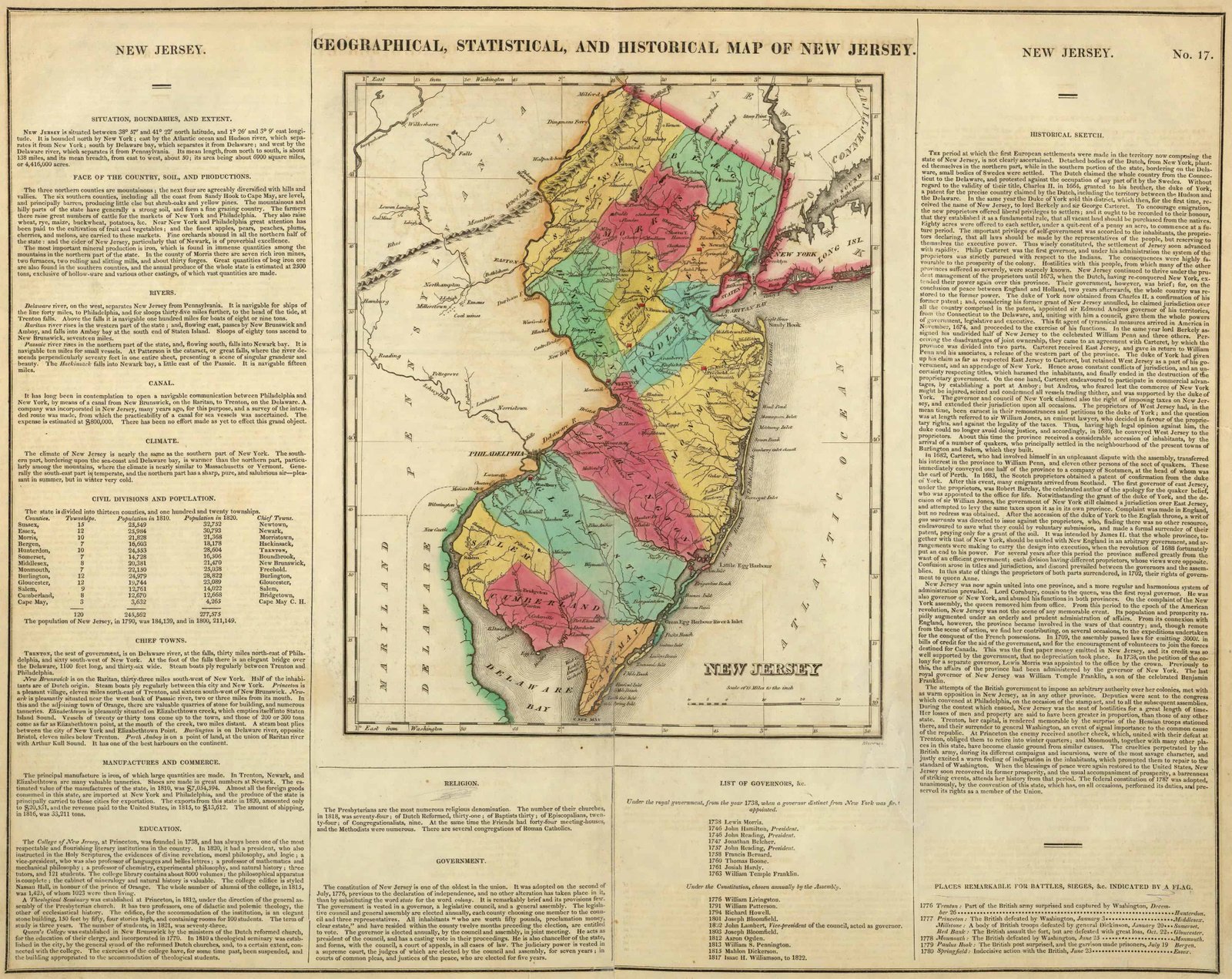
| Carey’s 1822 Geographical, Historical and Statistical State Map of New Jersey | |
| NEW JERSEY GEOLOGY – 1868 | |
| The Rochambeau March Map – 1782 | |
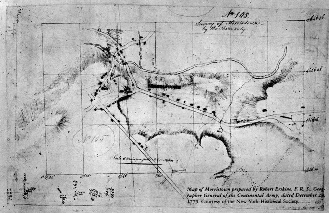
| Morristown 1779 – Robert Erskine, F. R. S., the Surveyor-General of the Continental Army |
| Map Geeks | Collection of historic digital Maps of New Jersey Jeffery’s 1776 Map of the Provinces of New York and New Jersey with part of Pennsylvania Carey’s 1795 State Map of New Jersey Compiled from the most Authentic Information Arrowsmith’s 1804 State Map of New Jersey Carey’s 1814 State Map of New Jersey Carey’s 1822 Geographical, Historical and Statistical State Map of New Jersey Finley’s 1827 State Map of Delaware, New Jersey and Pennsylvania Tanner’s 1836 State Map of New Jersey Colton’s 1856 State Map of New Jersey Mitchell’s 1880 State, County and Township Maps of New Jersey, Maryland and Delaware |
| 1873 – HUNTERDON / SOMERSET COUNTIES FW Beers | |
| 1850 – SOMERSET COUNTY – – Contributor: Otley, J. W. – Keily, James – Smith, Robert Pearsall – Van Derveer, Lloyd | |
| 1850 – Somerset County – Color – Relief shown by hachures. Inset : Plan of Somerville. Includes names of property owners and 7 views. LC Land ownership maps, 465 Available also through the Library of Congress Web site as a raster image. | |
| 1766 – Plan of Somerset County in the province of New Jersey : Copied from the original by Lieut. I. Hills, asst. engr. / survey’d by Benjamin Morgan. | |
| 1781 – Somerset County Survey – John Hills (Surveyor) Benjamin Morgan (Draftsman) | |
| 1935 Bridle Path Map of Somerset and Morris Counties | |
| 1940 Picture Map of Somerset County, New Jersey |
500+ Posts Honoring Jersey History"We keep researchin' " Top Weekly MLH Reads Top History All…
Our FUNDRAISING GOAL is Just $750 Want to bring our programs to the public and…
April 14th is National Garden Day, so make sure you get out there and enjoy…
UPDATE: Release Party: April 11, 2025 - The Flagship collectible is an artist rendering on…
I love John....and this is why... https://youtu.be/GJdH0Q0DltM?si=nC2xR9x2Dgbe_ZR4 "Site Unseen" Movie Trailer (Full documentary is now…
JARED IN THE NEWS: April 8, 2025 - Confirmation hearing Wednesday, April 9, 2025 at…
This website uses cookies.
View Comments
IF you build it, they will come. Sorry, we love maps and use them for our research all the time. Could be a cartoon map or a map from 1750, we have an entire map collection cause they tie back to history. Go for it.