National Award-Winning Landscape Architect Lives and Breathes History with His Map Creations.
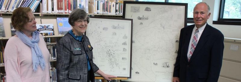
The Mr. Local History Project introduces you to a dear friend and history connoisseur who has taken cartography to a whole new level, overlaying history onto mapmaking to produce beautiful poster-sized objects disguised as art. Meet John Charles Smith and his maps of the Somerset Hills. The Somerset Hills is a northern section of Somerset County, New Jersey. Known to friends and locals as the John Smith maps, these are poster-sized lithographs showcasing streets, buildings, owners, and historic events. A true piece of collectible art, John has been creating these historic masterpieces for over 30 years.
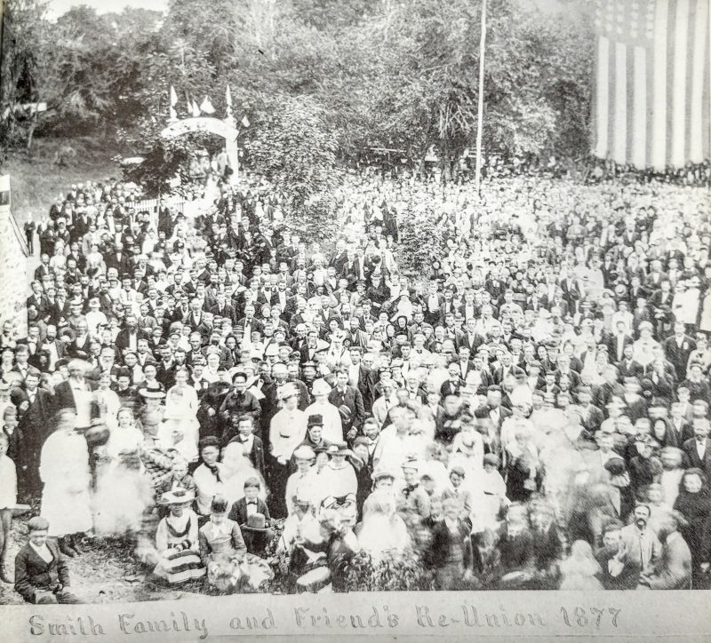
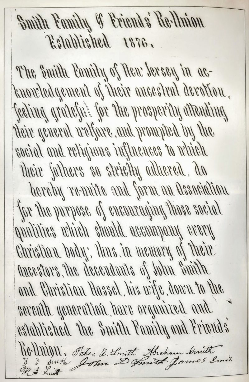
John’s passion for history started way before he created his first map. The Smith family holds weight around Peapack and the Somerset Hills area. Born and raised in the famed Smith family of Peapack and Gladstone, you can find images and stories about John’s family in many local history books. The Smith family is deeply tied to the area’s history. Also, they’re related to the Tiger family, so the Smiths naturally bring history to the table, as they have been part of our collective local fabric for over 250 years.
Smith Family History
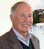
History comes naturally to John Smith. As you can see from the images below, the Smith family has been an institution in the area for over two centuries. John is also a graduate of Bernards High School, Cornell University, and the US Navy Candidate School in Newport, Rhode Island. He was married on February 22, 1969, to Linda Mudge of Bedminster at the Basking Ridge Presbyterian Church, where I catch him attending services today. He also serves on many nonprofit history boards in the area.
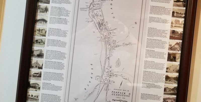
Before the map projects, John was giving local barn tours and presenting local history with his Peapack/Gladstone posters, which showcased local historic structures in the area surrounded by an old map (see below). He has since extended his map work to showcase the surrounding areas of Bedminster Township, Peapack-Gladstone, and Bernards Township, as well as more detailed maps of the hamlets of Liberty Corner, Basking Ridge, and Pluckemin.
John is also a devoted volunteer and fan of local history. John has served on just about every local history board, including leading or serving on the Peapack Gladstone Historic Preservation Board, the Jacobus Vanderveer House Board, Basking Ridge Presbyterian Church, and the Historical Society of Somerset Hills. These are just a few historical organizations that I’ve served with or supported John over the years. So, there’s no mistaking that John gives back to the history community, another reason his map art deserves our support.
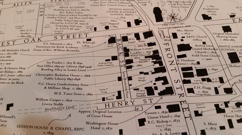
Historic Treasures in Every Map
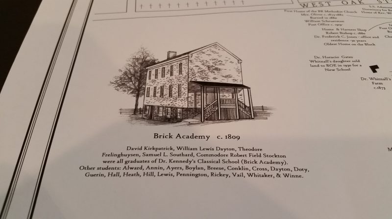
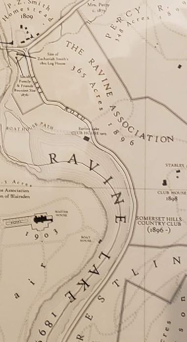
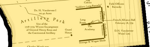
To understand the work John and his team have put into these works of art is the sheer amount of research they’ve done, reconstructing property lines and structure locations for the historic period. Each map reconstructs property boundaries and includes ALL the previous landowners, the years they owned the property, and all the structures on the property at that time. He has also added historical facts from the past around the edges of the map, including renderings of those structures’ importance. Again, we’re talking about a piece of art here! Historic churches, buildings, shops, and homes in Bernards are shown in drawings by artist Peter Pluchino. The placement of houses, outbuildings, roads, streams, and railroads is also illustrated.
In 2010, the Somerset County Cultural & Heritage Commission recognized John Smith with a Historic Preservation Award for Education for his Map of the Somerset Hills, which highlighted the period from 1893 to 1939.
It had to be an incredibly painstaking process to search deeds backward to reconstruct all those property boundaries to the map’s period. Whenever I do research, I like to start with John’s maps. I can tell you, I’ve been down to the county deed office in Somerville, and reconstructing an old property is not a fun project. John and his associates have done a great job preserving history.”
Brooks Betz, Bernards Township Historian and founder of the Mr. Local History Project
John Smith Map Collection
The Smith Map collection currently includes five maps. The bulk of the collection consists of maps for Bernards Township, Bedminster, and the Somerset Hills. Unframed maps are $200 each plus tax. The Basking Ridge and Bernardsville unframed maps are $175 each plus tax. Framed maps are available at an additional cost.
- The Somerset Hills 1893 – 1930
- Bedminster (including Peapack & Gladstone) 1873 – 1939
- Bernards Township (including Far Hills and Bernardsville) 1700 – 1930
- Bernardsville 1736 – 1901
- Basking Ridge 1700 -1930
Where To Find John Smith’s Maps on Display
Based on our travels around Somerset County, here are a few places where you can see John’s maps in all their glory (mounted and laminated), We wouldn’t be surprised if John’s charity kicked in as I bet he donated these works of art to each of the institutions.
Check locations for hours and access.
- Map of Bernardsville: Bernardsville Library – Entrance Hallway
- Map of Bernards Township: Bernards Township Library – Front right reading room
- Map of Basking Ridge in Bernards Township: Bernards Township Library – Ask at the Reference Desk
- Map of the Somerset Hills: Clarence Dillon Public Library Bedminster – Downstairs Community Room
- Map of Bedminster Township (Includes Peapack & Gladstone) : Trump National Golf Course – Upstairs Dining Room
If you spot one of John’s classic maps in a public setting, let us know and we’ll update our list.
Where To Get a John Smith Map
Sadly, John Smith’s maps are not available online. Since you can’t purchase online, the best way to get a John C. Smith Map is to call John’s office at (908) 234-1121. He once had a website, but it’s no longer active. Email is also currently not available. John is a classic old-school Renaissance man.
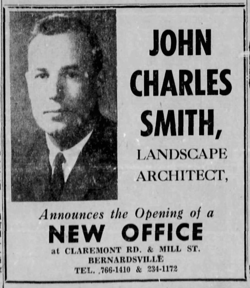
About John Charles Smith Landscape Architects
Established in 1965, the firm has completed designs for many public gardens, commercial landscapes, and hundreds of residential projects, including many historic estates, farms, woodland gardens, and country homes. The firm has won national awards from the American Society of Landscape Architects, recognized for numerous ASLA Chapter Awards for design excellence, and received several accolades from the prestigious Perennial Plant Association.
Several of the firm’s constructed projects have been published in notable design magazines, including Landscape Architecture, Garden Design, and Architectural Digest; and other projects have appeared in several books on Garden Design and Landscape Architecture. Its founder and principal designer, John Charles Smith, is a member of the ASLA and operated his practice for over 40 years. John’s office is based in Far Hills, New Jersey. John Charles Smith Landscape Architects is at 35 Branch Rd, Far Hills, NJ 07931. Tel. 908-234-1121


There is a postcard of Echo Lake, Pluckemin in Steck’s Deli. Where is Echo Lake or where was it and what happened to it?