WHAT’S SHAKIN – JERSEY IS!
New Jersey’s been doing its best California impression lately, minus the avocado toast. In the last few weeks, the Garden State gave us a couple of surprise jiggles, just enough to knock over a garden gnome and convince Phil from Paramus that his recliner was possessed. Scientists say it’s nothing to worry about, but tell that to the guy who spilled his Wawa coffee during the Hillsdale quake, he’s still filing emotional damage claims. On Saturday night, August 2, 2025, a magnitude 3.0 quake struck near Hasbrouck Heights, about eight miles west of Central Park. The tremor occurred around 10:20 p.m. and was felt across the New York metro area, parts of Connecticut, and even into Virginia—though no damage was reported, aside from startled pets and shaken coffee mugs. Just a few days later, on Tuesday, August 5, 2025, another quake, a magnitude 2.7, hit near Hillsdale, New Jersey at around 12:11 p.m. This one was also shallow, with a depth of about 7 miles, and was felt by hundreds of people in northern New Jersey, New York City, and as far as western Connecticut. Once again, the earth gave a gentle shrug, and New Jerseyans responded with equal parts confusion and memes. These tremors follow the more significant April 5, 2024, magnitude 4.8 earthquake centered near Tewksbury Township, which was the strongest quake in the state in over a century and produced numerous aftershocks throughout the region.
The Big One – April 5, 2024
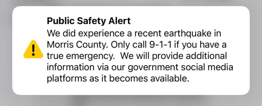
On a cool spring morning on Friday, April 5, 2024, at 10:23 am history was made as about 1/4 mile below the earth’s surface in the quiet Hunterdon County town of Tewkesbury, headlines were made as a 4.8 magnitude earthquake broke the morning silence with what was one of the strongest earthquakes hitting the east coast in over 200 years. Luckily, so far no major damage has been reported.
Earthquake Cause – Whose FAULT Was It?
The Ramapo Fault is a significant geological feature located in the eastern United States. It stretches approximately 185 miles (300 kilometers) from Pennsylvania through New Jersey and into New York State. It formed during the breakup of the supercontinent Pangaea around 225 million years ago during the Triassic Period. It is classified as a right-lateral strike-slip fault, meaning that the movement of the Earth’s crust along the fault is predominantly horizontal and in a right-lateral direction.
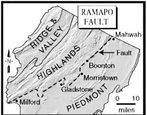
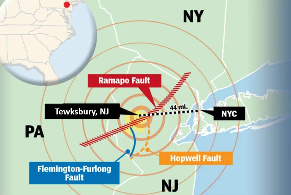
Over millions of years, the Ramapo Fault has experienced intermittent periods of seismic activity, resulting in earthquakes of varying magnitudes. While the fault is not as well-known for its seismic activity as some others in the western United States, it remains an active geological feature capable of producing earthquakes.
Native American tribes that inhabited the region around the Ramapo Fault likely experienced its seismic activity firsthand. While there is limited direct historical evidence, geological studies and oral traditions from indigenous peoples suggest that earthquakes may have shaped their understanding of the natural world.
European settlers began to inhabit the area around the Ramapo Fault in the 17th century. While early settlers may not have been aware of the fault’s existence or significance, they likely experienced its occasional seismic activity.
The Ramapo Fault has been the subject of geological study for many years. Scientists have used various methods, including seismology, geological mapping, and remote sensing, to better understand its structure, activity, and potential seismic hazards.

The Epicenter – Tewksbury, New Jersey
Tewksbury Township is a historic township located in Hunterdon County, New Jersey. It was settled by European colonists, primarily of English and Dutch descent, in the early 18th century. The area was originally inhabited by the Lenape Native American tribe. The township was officially established in 1755 when it was set apart from Lebanon Township. Tewkesbury was named in honor of an English town in the north of Gloucestershire, England. Since 2003, Tewksbury Township and Tewkesbury, England, have been twinned communities.
Like much of the surrounding region, Tewksbury Township played a role in the American Revolutionary War. The area saw troop movements and skirmishes; some residents likely participated in the conflict. In recent decades, there has been an emphasis on preserving the historic character and rural landscape of Tewksbury Township. Efforts have been made to protect farmland from development and to maintain the area’s historic buildings and landmarks.

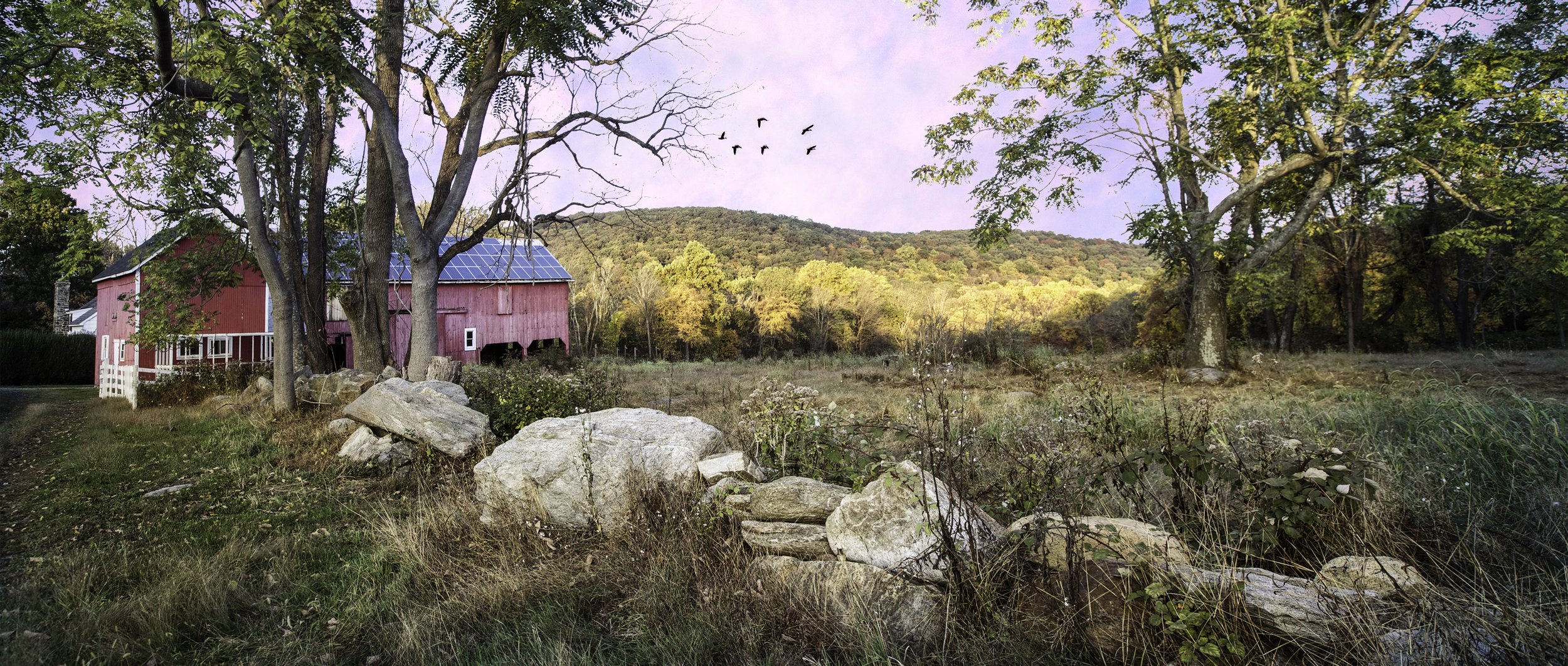
Source: Gladstone Equestrian Association and the Tewksbury Land Trust
Another unique feature of the town is the Tewksbury Foot Bassets. While hunting live foxes with hounds is now heavily regulated and restricted, packs like the Tewksbury Foot Bassets still participate in legal forms of hunting such as drag hunting, where an artificial scent is laid for the hounds to follow. The pack traditionally hunts on foot rather than on horseback, hence the name “Foot Bassets.” This method of hunting involves following the hounds on foot as they track the scent of foxes through fields, woodlands, and other terrain.
Today, Tewksbury Township retains much of its rural character, with farms, open space, and historic properties still defining its landscape. The township is also home to a close-knit community of residents who value its natural beauty and historical heritage.
1783 New Jersey 5.3 Earthquake
One of the most significant earthquakes in New Jersey’s history occurred on November 30, 1783. It had an estimated magnitude of around 5.3 to 5.4 and caused damage to buildings and structures in the area. The earthquake was felt across a wide area, including New Jersey, New York, Pennsylvania, and Connecticut. So our question remains is how did they measure that earthquake back then before Charles F. Richter’s Richter scale wasn’t invented until 1934 (a story for another day.) For earthquakes prior to about 1890, magnitudes have been estimated by looking at the physical effects (such as the amount of faulting and landslides plus the human effects (such as the area of damage, felt reports, or how strongly a quake was felt.
In 1927, there was another big Jersey shaker. While the epicenter of this earthquake was in Jericho, New York, it was also felt in neighboring New Jersey. The earthquake, which occurred on September 5, 1927, had a magnitude of 4.7 and caused minor damage to buildings in the region.
So Now What?
Today, the Ramapo Fault is recognized as one of the major geological features in the eastern United States. While it is not as seismically active as other faults in regions like California, it remains a concern for seismic hazard assessment and preparedness in the densely populated northeastern United States.
And Finally…..Jersey Being Jersey

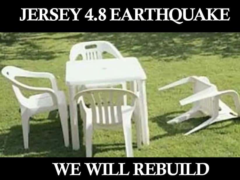
Given the proximity of major population centers such as New York City to the Ramapo Fault, understanding its potential for seismic activity is crucial for risk assessment and disaster preparedness efforts. Efforts to monitor and study the fault continue to contribute to our understanding of its behavior and the potential impacts of future earthquakes in the region. But for now, that quiet little town of Tewksbury is forever known not for its Tewksbury Foot Bassets or fall apple picking but for being the epicenter of New Jersey’s most historic earthquake.


Love the history.